 |
Global Ocean Associates` |

Astronaut photographs showing the brightness reversals of ocean surface signatures. (a)
ISS005-E-13119 and (b) ISS005-E-13121 of Cap-Vert peninsula in Senegal, Africa, acquired on
7 September 2002 near 13:16 UTC; (c) ISS004-E-13597 and (d) ISS004-E-13599 of an oil slick in
the Pacific Ocean acquired on 22 April 2002; and (e) ISS009-E-7788 and (f) ISS009-E-7792 of a
high-frequency internal solitary wave packet in the Bali Sea near the Indonesian island Kepulauan
Kangean acquired on 18 May 2004. Astronaut photographs are courtesy of the Image Science and
Analysis Laboratory, NASA Johnson Space Center. “The Gateway to Astronaut Photography of Earth.”
(Available at http://eol.jsc.nasa.gov.) |
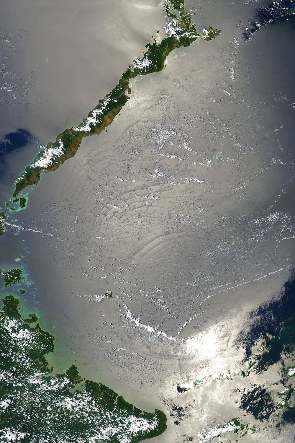
Nonlinear Internal Waves in the Sulu Sea
 |
MODIS (Terra) True-Color (Bands 1,3,4) 250-m resolution visible image of the Sulu Sea acquired on 8 April 2003 at 0520 UTC. Four packets of large solitons are visible in the sunglint region. Imaged area is 370 km x 500 km. See Also: http://www.internalwaveatlas.com/Atlas2_PDF/IWAtlas2_Pg393_SuluSea2.pdf, http://earthobservatory.nasa.gov/IOTD/view.php?id=3586 |
Winds Derived from Synthetic Aperture Radar Imagery
 |
An image of the surface wind speed derived from an Envisat Advanved Syntheric Aperture Radar (ASAR) Wide Swath image acquired on 24 September 2008 at 0235 UTC. The roughness of the sea surface from winds cause variations in the amount of radar energy returned. These variations can be related back to the wind speed. See: http://www.star.nesdis.noaa.gov/sod/mecb/sar/PUBLICATIONS/SARUsersManual/NOAASARManual_CH13_pg305-320.pdf, |